
DRONE PHOTOGRAPHY & FILMING IN MONMOUTH
AERIAL PHOTOGRAPHY & DRONE FILMING MONMOUTH
Professional drone photography and aerial video across Monmouth and the surrounding Wye and Monnow valleys for property, farms, estates, construction, tourism, business and production work.
The town centre, rivers, busy roads, business areas and surrounding countryside all create different operating conditions, so each flight is planned around the exact location and the shots required.
PROFESSIONAL DRONE SERVICES
Photography, video & production
✓ GVC qualified
✓ A2 CofC qualified
✓ Commercial drone insurance
✓ High-resolution aerial stills
✓ 4K / 6K aerial video
✓ Ground filming available
| DRONE WORK ACROSS MONMOUTH | PROPERTY • BUSINESS • COUNTRYSIDE |
DRONE PHOTO VIDEO SERVICES LOCAL TO MONMOUTH
Town centre, rivers and busy roads
Monmouth town centre, the River Monnow, River Wye and surrounding roads create a more congested operating environment than the open countryside nearby. The exact take-off position and requested view matter.
Property, estates and land
Aerial photographs can show homes, commercial buildings, farms, estates and development land in their wider setting, including access, surrounding fields and the relationship between several buildings.
Commercial and construction sites
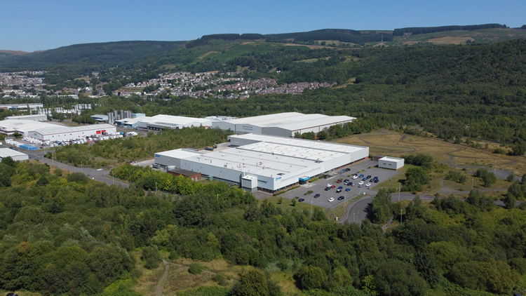
Business premises and developments around Wonastow Road and western Monmouth can be photographed for property marketing, progress records, site context and company films.
Tourism and rural businesses
The Wye and Monnow valleys provide strong context for accommodation, visitor businesses, farms, vineyards, estates and countryside locations where the setting is part of the story.
Ground and aerial filming together
Where the final film needs more than aerial imagery, the same project can include interviews, ground-camera footage, close detail, professional sound and editing.
MONMOUTH DRONE SERVICES
Aerial photography and video for property, business and production work
The useful aerial view depends on what needs to be shown: setting, access, scale, progress, landscape, activity or the relationship between different parts of a site.
Property & land
Show houses, estates, farms, commercial buildings and development land with aerial views that make access, boundaries and setting easier to understand.
Construction & development
Document site layout, infrastructure, progress and completed work for developers, contractors, reports and marketing.
Tourism & rural business
Accommodation, visitor attractions, farms, vineyards and rural businesses can use the surrounding landscape as genuine location context.
Business & production
Capture establishing shots, reveals and planned movements for business films, documentaries, campaigns and agency productions.
MONMOUTH, THE WYE & MONNOW VALLEYS
Aerial coverage that explains the location, not just the view
Monmouth sits where the River Monnow meets the River Wye, with the compact town giving way quickly to business sites, farms, wooded hills and open countryside. That variety is useful on camera, but it also means the operating plan can change significantly from one job to the next.
Property and estates
Aerial stills can show grounds, access, boundaries and the relationship between buildings more clearly than ground photography alone, particularly on larger homes, estates and rural property.
Construction and business
Commercial sites and developments can use planned aerial views to show layout, access, progress and scale. Repeat visits can be based around consistent viewpoints where comparison matters.
Tourism and countryside
Riverside locations, accommodation, attractions and rural businesses benefit from aerial imagery when the surrounding valley or countryside is part of what the client needs to communicate.
Production work
For business films and agency productions, the aerial sequence is planned around the edit rather than treated as a separate collection of scenic shots.
DRONE COVERAGE AROUND MONMOUTH
Town centre, business areas and surrounding valleys
The exact location matters more than the postcode. A flight beside a busy road or historic landmark needs a different approach from a farm or estate a few miles away.
Monmouth town centre & Monnow Bridge
Historic streets, Monnow Bridge and the river can give a film a clear Monmouth identity, but roads, pedestrians, land access and the operating position need to be considered before a particular shot is promised.
Wonastow Road & western Monmouth
Commercial premises, development and larger sites around Wonastow Road suit construction updates, property photography and business films, with vehicle movements and neighbouring operations considered in the plan.
Wye Valley, Redbrook & Penallt
Tourism businesses, accommodation, woodland, riverside property and rural sites south of Monmouth can make strong use of the Wye Valley setting, with tree cover and terrain built into the flight plan.
Mitchel Troy & the Monnow Valley
Farms, estates, rural businesses and accommodation around the Monnow Valley benefit from aerial context, particularly where several buildings, fields or access routes need to be shown together.
Rockfield & surrounding countryside
Rural property, farms, estates and countryside businesses can use aerial stills or video to show access, scale and surrounding land without relying on a generic wide landscape shot.
Wider Monmouthshire
Coverage also extends across Monmouthshire for property, farms, construction, tourism and commercial projects where planned aerial imagery adds useful context.
HOW A MONMOUTH DRONE SHOOT WORKS
Plan the view before the drone goes up
Send the exact site, what needs to be shown and how the material will be used. We can then assess the practical flight position before attendance rather than trying to solve everything after arriving.
01
Send the location and brief
Include the required stills or video, final use, preferred date and any useful access or site information.
02
Assess the operating environment
We check airspace, people, roads, buildings, land access, trees, weather and practical take-off positions.
03
Capture the useful angles
We work through the agreed priorities efficiently, adapting the operating position where the site or conditions require it.
04
Receive the right files
Edited photographs, organised source footage, graded clips or a finished film are supplied in the format agreed for the project.
MONMOUTH DRONE FAQ
Practical questions before booking
Send an address or map pin for advice based on the actual site rather than a generic answer for Monmouthshire.
Can you fly a drone in Monmouth town centre?
Potentially, but the requested shot must be assessed first. Roads, pedestrians, buildings, riverside areas, the take-off point and the aircraft being used all affect what is practical.
Can you film Monnow Bridge and the rivers?
Potentially, subject to the exact operating position and permissions. River locations can involve public paths, trees, wildlife, roads and land controlled by different owners, so the specific view needs to be checked first.
Do you cover rural properties, farms and estates?
Yes. Rural Monmouthshire is well suited to property, estate, farm, vineyard and accommodation imagery. Flights are planned around access, workers, livestock, neighbouring property, trees and weather.
Can you photograph business or construction sites near Wonastow Road?
Yes, subject to the site and surroundings. Aerials can be useful for property, development, progress and company films, with vehicle movements, neighbouring units and the safest operating area checked in advance.
Can you make repeat progress visits?
Yes. Return visits can be planned around project milestones and consistent viewpoints so change is easier to compare, while allowing for weather and changes on site.
Can you combine drone footage with ground filming?
Yes. Interviews, ground-camera footage, close detail, sound and editing can be added when viewers need explanation as well as aerial context.
Can I receive photographs and video from one visit?
Yes, where the schedule and conditions allow. One attendance can include high-resolution stills and video clips, supplied in the form agreed for the job.
What happens if the weather is unsuitable?
Flights only proceed in suitable conditions. Wind, rain, visibility and the direction of the required shots all matter, so where possible the aerial work is moved to a better weather window rather than forcing a poor flight.
DRONE PHOTOGRAPHY MONMOUTHSHIRE WALES
Need aerial photography or drone filming in Monmouth?
Send the address or map pin, preferred date and the photographs or video shots you need. We can then assess the site and respond with a practical approach and quotation.