
LAND DEVELOPMENT DRONE PHOTOGRAPHY & VIDEO ACROSS WALES
LAND DEVELOPMENT DRONE SERVICES IN WALES
Professional aerial photography and drone filming for developers, landowners, contractors, housing providers, architects and property teams.
Create a clear baseline before work starts, return for useful progress records as the scheme develops, then reuse the final aerial imagery for stakeholders, sales, case studies and the completed-project archive.
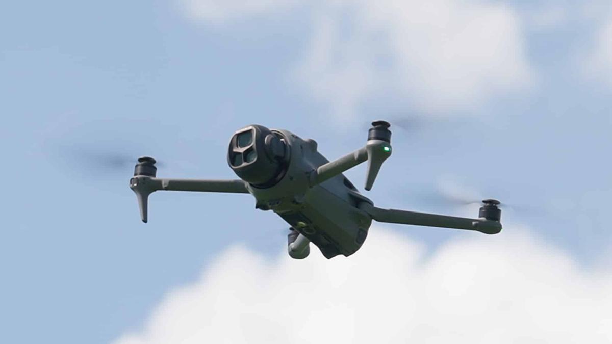
SITE-READY AERIAL COVERAGE
From untouched land to completed scheme
GVC + A2 CofC qualified
£1m public liability insurance
High-resolution aerial photography
4K / 6K aerial footage
Single or repeat visits
RAMS / site coordination where required
Need interviews or ground filming too?
See construction video production →
| DEVELOPMENT COVERAGE PLANNING | WHAT WILL STILL MATTER SIX MONTHS FROM NOW? |
Plan the visual record before the site changes
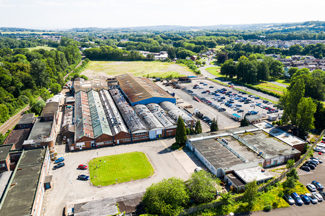
Start with a proper baseline
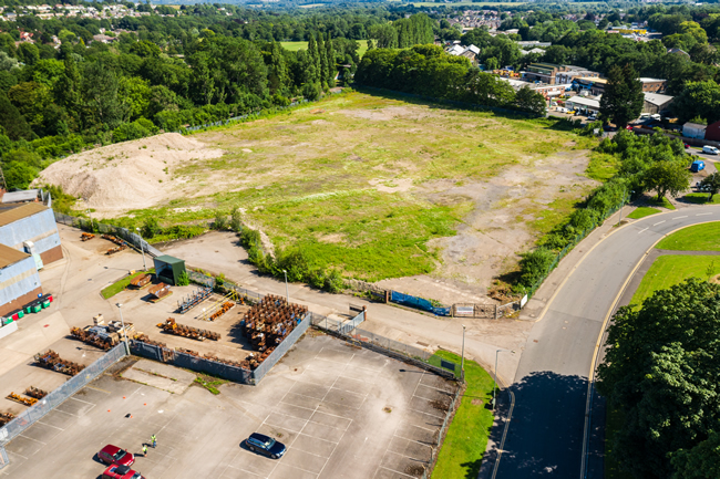
Before clearance or construction begins, record the existing site, entrances, neighbouring land, visible structures and wider context. Those images become the reference point for later change.
Choose repeat views that will survive the build
A very low viewpoint may disappear behind finished buildings later. The first visit is used to choose useful directions and heights that can remain readable as the scheme develops.
Let milestones drive the schedule
Monthly visits suit some long programmes, but pre-start, earthworks, infrastructure, roof stage, landscaping and completion can be more useful than arbitrary calendar dates when visible change is uneven.
Separate photography from measured surveying
This service is professional visual documentation, not a topographical survey, LiDAR capture, legal boundary survey or engineering measurement. Client-supplied plans can guide illustrative labels without changing that distinction.
Decide how the archive will be used
Project managers may need consistent reporting views while sales and marketing teams need cleaner imagery later. Both can be anticipated without turning every visit into the same shot list.
LAND DEVELOPMENT AERIAL SERVICES
Four practical reasons to commission the flight
The brief can concentrate on one requirement or combine several during the same visit.
Pre-development record
Create a dated visual baseline of the site before demolition, clearance, earthworks or construction changes what is visible.
Progress monitoring
Return at agreed milestones and combine repeat viewpoints with current-phase coverage of whatever is changing on the site.
Plot & sales imagery
Show plots, completed phases, access, landscape and nearby infrastructure for websites, brochures, investor material and sales campaigns.
Stakeholder evidence
Supply clear aerial evidence for client updates, funders, housing providers, remote teams, reports, bids and completed-project records.
FROM GREENFIELD TO HANDOVER
What changes in the aerial brief as the development moves forward?
The purpose of the photography should change with the project. A baseline image and a finished sales photograph are not trying to prove the same thing.
01
Before works
Record the undeveloped or existing site, entrances, visible buildings, vegetation and relationship to neighbouring land before machinery arrives.
03
Build & sales phase
Keep project-record views while adding cleaner photographs of completed plots, roads, landscaping and show areas when marketing begins to matter.
02
Enabling & infrastructure
Show earthworks, roads, drainage, retaining work, utilities routes and foundations so the developing layout is easy to understand from above.
04
Completion & archive
Return to the original reference directions, then add final imagery for handover, case studies, awards, investor records and future bids.
DEVELOPMENT PROGRESS IN CONTEXT
Movement is useful when it explains scale and relationship
The existing Drone South Wales video example is retained below. On a development site, aerial video is normally planned alongside still photography rather than replacing the repeat photographic record.
USEFUL CAMERA MOVEMENT
Show how separate parts of the site connect
A slow approach, reveal or lateral move can explain access, scale and the relationship between plots more clearly than a sequence of unrelated clips.
For repeat visits, the priority remains the agreed documentary views. Additional moving shots can then respond to the current phase — for example infrastructure, active construction, completed landscaping or the finished scheme.
DELIVERY OPTIONS
Build an archive people can actually use
Edited high-resolution aerial photographs
4K / 6K source footage
Repeat-viewpoint image sets
Files named by date or milestone
Short stakeholder update edits
Sales and marketing aerials
Simple labels from client-supplied plans
Before-and-after completion sets
ONE FLIGHT, SEVERAL AUDIENCES
The same site may need to communicate different things to different people
Developers and project managers usually need progress and context. Funders and housing providers may need concise stakeholder evidence. Sales teams want attractive finished phases and clear location imagery. Contractors may later want case-study material.
Plan the output rather than dumping a folder of files
A repeat project benefits from simple naming by date or milestone. Selected images can then be pulled quickly into reports, presentations or marketing without somebody having to rediscover the site history each time.
Related technical projects
For roads, utilities and engineering-led work, see civil engineering drone services. For active build progress, see construction drone photography.
NEED THE PROJECT STORY, NOT JUST THE AERIAL RECORD?
Ground filming, interviews and site activity can be added through South Wales Video
Drone South Wales can provide the aerial photography and footage as a standalone service.
For a development case study, stakeholder film, contractor story or completed-project video that also needs interviews, machinery, people and ground cameras, use the dedicated construction-video service.
LAND DEVELOPMENT DRONE COVERAGE ACROSS WALES
Development-site photography planned around the location
Send the exact site address or map pin. Airspace, roads, neighbouring property, live works and practical take-off positions can vary significantly even between nearby developments.
Cardiff
Housing, regeneration, commercial and mixed-use developments across Cardiff and Cardiff Bay. Urban sites can require closer planning around airspace, roads, cranes and public interfaces. Cardiff drone services.
Newport and Cwmbran
Swansea and Bridgend
Caerphilly, Merthyr and the Valleys
Housing, regeneration and hillside sites across Caerphilly, Merthyr Tydfil, Pontypridd and the Valleys, where terrain can make aerial context particularly useful. Caerphilly · Merthyr Tydfil.
Abergavenny and Monmouthshire
Residential, rural and commercial sites around Abergavenny, Monmouth, Usk and the wider county. Abergavenny · Monmouthshire.
Brecon and Powys
Carmarthenshire and Pembrokeshire
Housing, land and commercial development across West Wales, where weather, coastline and larger rural sites can influence the operating plan. Carmarthenshire · Pembrokeshire.
Across Wales and the Borders
Projects can also be planned across Mid Wales and the border counties where the site, programme and travel requirements make sense. Send the map pin for a practical assessment.
HOW DEVELOPMENT COVERAGE WORKS
A simple operational route from site plan to usable archive
The process stays concise even when the aerial record continues for months or years.
01
Send the site plan and current phase
Provide the map pin, site contact, current programme stage and who will use the images. Client plans can also identify areas that deserve particular attention.
02
Check airspace and site operations
Airspace, roads, cranes, plant, workers, public interfaces, access and suitable operating positions are reviewed. Induction and RAMS requirements are agreed where necessary.
03
Capture the agreed visit
The flight covers the reference views plus the current phase. Later visits reuse the references where practical and add new views only when the changing project justifies them.
04
Deliver and organise the archive
Edited stills, source footage or finished edits are supplied as agreed, with sensible naming so later reports and before-and-after comparisons remain easy to assemble.
LAND DEVELOPMENT DRONE FAQ
Questions developers and project teams ask before booking
Send the exact development location and current site phase for advice based on the real operating environment.
Can you repeat the same aerial viewpoints throughout a development?
Yes. Reference views can be recorded on the first visit and recreated as closely as site conditions allow. Cranes, buildings, vegetation, access and GPS tolerance mean exact pixel-for-pixel repetition cannot be promised.
How often should a development be photographed?
There is no universal interval. Monthly coverage suits some long programmes; other schemes benefit more from visits tied to visible milestones such as pre-start, infrastructure, structure, landscaping and completion.
Can you show plot or site boundaries?
Simple illustrative overlays can be created from an authoritative plan supplied by the client. They are presentation graphics only; ordinary aerial photography is not a legal boundary or cadastral survey.
Can you photograph an active development site?
Yes, subject to the site and current conditions. Workers, plant, cranes, deliveries, roads and available operating space are considered with the site contact before and during attendance.
Can aerial imagery support planning or stakeholder reports?
Yes, as visual supporting material. The images can explain visible site context and progress, but they do not replace formal plans, technical drawings, surveys or professional assessments required by a planning authority or consultant.
Do you provide mapping, LiDAR or topographical surveys?
Not as part of this service. Measured geospatial data, point clouds, engineering survey outputs and legal boundary work should be commissioned from an appropriately equipped surveying provider.
Can you provide both aerial photographs and video?
Yes. High-resolution stills and 4K / 6K aerial footage can be captured during the same visit where the brief and available flight time allow.
Can you supply raw footage to our agency or in-house team?
Yes. Organised source material can be supplied to an external editor, agency or internal marketing team, or edited images and finished aerial sequences can be delivered instead.
Can you combine the drone work with interviews and ground filming?
Yes. For a project case study or construction film that needs interviews, site activity, ground cameras and sound as well as aerial footage, use South Wales Video’s construction filming service.
Can later visits be shorter once the reference views are established?
Often. Once the site procedure and reference views are known, a later visit can concentrate on the agreed comparison images and a small number of current-phase shots, subject to access and changing site conditions.
How are repeat-visit files organised?
Files can be separated by visit date or project milestone so the archive remains straightforward to compare and reuse in reports, presentations, tenders and the final before-and-after story.
What happens if weather or site conditions change?
Flights only proceed when conditions are suitable. Wind, rain, temporary restrictions, cranes, new structures or changed access can affect a planned viewpoint. The original reference is retained even when a safe adjustment is necessary.
LAND DEVELOPMENT DRONE SERVICES WALES
Start the aerial record before the useful “before” view disappears
Send the site address or map pin, current phase, likely programme and what the imagery needs to show. A single baseline visit or a repeat development archive can then be planned around the real project.