DRONE PHOTOGRAPHY & VIDEO IN POWYS
AERIAL PHOTOGRAPHY & DRONE FILMING POWYS
Professional drone photography and aerial video across Powys for property, land, agriculture, construction, inspections, tourism, events and commercial projects.
From Brecon and Hay-on-Wye to Builth Wells, Llandrindod Wells, Welshpool and Newtown, we cover projects across this large rural county, including farms, estates, businesses, developments and visitor locations.
PROFESSIONAL DRONE SERVICES
Photography, video & inspections
✓ GVC qualified
✓ A2 CofC qualified
✓ Commercial drone insurance
✓ High-resolution aerial stills
✓ 4K/6K aerial video
✓ Flight planning included
| DRONE WORK ACROSS POWYS | PROPERTY • BUSINESS • TOURISM |
AERIAL COVERAGE ACROSS A LARGE RURAL COUNTY
Property, land and larger sites
Aerial photographs can show the relationship between buildings, grounds, access, neighbouring land and the surrounding landscape far more clearly than ground photography alone.
Commercial and construction projects
Business premises, industrial sites and developments around Carmarthen, Llanelli and Ammanford can be photographed for marketing, progress records, site context and planned promotional films.
Tourism, accommodation and outdoor businesses
The Brecon Beacons, Black Mountains, Cambrian Mountains, reservoirs, trails and open countryside provide strong context for visitor attractions, accommodation, outdoor businesses and destination marketing.
Roof and building inspections
Focused aerial photographs can provide a clear view of roofs, chimneys, elevations and other difficult-to-see areas without producing piles of unnecessary material.
Rural and upland flight planning
Distance, mountain weather, livestock, terrain and remote access can all affect rural flights. We check the exact location beforehand and plan the operating position around the real conditions on the ground.
POWYS DRONE SERVICES
Drone video and photography for property, business and the wider area
From farms and rural property to roof inspections, tourism, construction and commercial filming, we provide practical aerial coverage across Powys.
Property & land
Show homes, rural property, grounds, fields and access with clear aerial views that make the layout and setting easier to understand.
Tourism & hospitality
Accommodation, attractions, outdoor activities and visitor businesses can use the surrounding landscape as genuine location context.
Construction & commercial
Document developments, business premises, yards, external works and progress around Powys, Cinderford, Lydney and the wider district.
Roof & site inspections
Focused aerial stills can show roofs, elevations, chimneys and hard-to-see areas, subject to a safe operating position with clear visibility.
MID WALES, MARKET TOWNS & OPEN COUNTRYSIDE
Aerial photography across a remarkably varied area
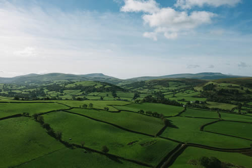
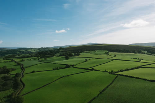
Powys covers a huge part of Mid Wales, combining market towns, farms, estates, mountains, river valleys, visitor attractions and commercial sites. Aerial photography is particularly useful where scale, access and setting are difficult to show from the ground.
Property and land
Aerial photography is useful for houses, estates, farms, development land and commercial property where conventional ground photographs cannot show the complete setting.
Tourism and hospitality
Hotels, holiday accommodation, attractions and outdoor businesses can use drone photography and video to show their location and surrounding countryside in a way ground-level images cannot.
Construction and business
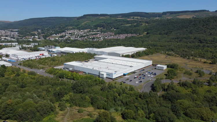
Brecon, Newtown, Welshpool, Llandrindod Wells and other Powys towns include business parks, developments and working premises where aerial coverage can show scale, access and progress clearly.
The Wye Valley and rural locations
Rural sites can produce excellent aerial material. Where dense trees or steep terrain affect the pilot’s visual line of sight to the drone, we simply plan the operating position accordingly.
DRONE COVERAGE ACROSS POWYS
From the Brecon Beacons to the north of the county
Powys is a large county, so we plan travel and flight requirements around the individual job. Coverage includes the main towns and the many rural communities between them.
Brecon & Bannau Brycheiniog
Brecon, Sennybridge, Talybont-on-Usk, Llangorse and surrounding communities for tourism, property, farms, events and commercial work. See our dedicated Brecon drone photography page.
Hay-on-Wye & Talgarth
Hay-on-Wye, Talgarth, Glasbury and the surrounding border countryside for tourism, accommodation, estates, rural property and land. See Hay-on-Wye drone photography.
Builth Wells & Rhayader
Builth Wells, Rhayader, Llanafan-fawr and nearby areas for agriculture, events, property, tourism, inspections and commercial projects.
Llandrindod Wells & Presteigne
Llandrindod Wells, Presteigne, Knighton and the central border area for property, business, construction, land and tourism work.
Newtown & Llanidloes
Newtown, Llanidloes, Caersws and surrounding Mid Wales communities for manufacturing, commercial property, construction, farms and inspections.
Welshpool & Montgomery
Welshpool, Montgomery, Berriew and surrounding areas for industrial sites, estates, agriculture, property and promotional filming.
Machynlleth & north-west Powys
Machynlleth, Llanbrynmair and the north-western part of Powys can be covered for tourism, rural property, land, environmental and commercial projects.
Crickhowell & the south-east
Crickhowell and nearby south-east Powys are particularly convenient for rapid local coverage. See our dedicated Crickhowell drone photography page.
HOW A POWYS DRONE SHOOT WORKS
Simple planning before the drone goes up
Send us the location, what you need photographed or filmed and how the material will be used. We can then plan the right aircraft, shots and operating position before attendance.
01
Send the exact location
Include the required stills or video, intended use and any useful access or landowner information.
02
Plan the flight
We check the site, airspace, access, weather and the shots needed before attendance.
03
Capture the required angles
We work through the agreed stills or video shots efficiently, adapting the flight position where the site requires it.
04
Receive organised files
Edited photographs, agreed clips or source footage are supplied digitally for marketing, reporting, property or production use.
DRONE PHOTOGRAPHY POWYS
Need aerial coverage in Powys?
Send the excact location and tell us what you need. A map pin, what3words, brief shot list or example image is useful for planning the shoot.