DRONE PHOTOGRAPHY & VIDEO IN COLEFORD & THE FOREST OF DEAN
AERIAL PHOTOGRAPHY & DRONE FILMING COLEFORD
Professional drone photography and aerial video across Coleford and the Forest of Dean for property, tourism, construction, land, inspections, events and commercial projects.
We provide flexible aerial coverage for businesses, property owners, agents, developers and organisations throughout the area, with shoots planned around the subject, access and intended use.
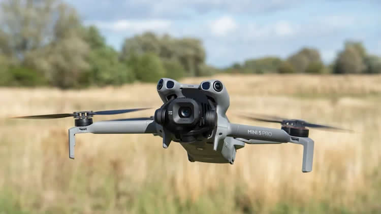
PROFESSIONAL DRONE SERVICES
Photography, video & inspections
GVC + A2 CofC qualified
✓ Commercial drone insurance
✓ High-resolution aerial stills
✓ 4K/6K aerial video
✓ Property & commercial work
✓ Local and rural locations
| DRONE WORK IN THE FOREST OF DEAN | PROPERTY • BUSINESS • TOURISM |
AERIAL COVERAGE ACROSS FOREST OF DEAN

Property, land and larger sites
Aerial photographs can show the relationship between buildings, grounds, access, neighbouring land and the surrounding landscape far more clearly than ground photography alone.
Commercial and construction projects
Business premises, industrial sites and developments around Coleford, Cinderford and Lydney can be photographed for marketing, progress records, site context and planned promotional films.
Tourism, accommodation and outdoor businesses
The Forest of Dean and Wye Valley provide strong surroundings for holiday accommodation, attractions, venues and outdoor businesses where the location itself is part of what is being promoted.
Roof and building inspections
Focused aerial photographs can provide a clear view of roofs, chimneys, elevations and other difficult-to-see areas without producing piles of unnecessary material.
Woodland and visual line of sight
One local consideration is the amount of tree cover. The pilot must maintain visual line of sight with the drone, so on heavily wooded or steep sites the take-off position may need to be chosen carefully or the work split into more than one short flight.
COLEFORD & FOREST OF DEAN DRONE SERVICES
Drone photography and filming for property, business and the wider area
From property and roof inspections to tourism, construction and commercial filming, we provide practical aerial coverage across Coleford and the wider Forest of Dean.
Property & land
Show homes, rural property, grounds, fields and access with clear aerial views that make the layout and setting easier to understand.
Tourism & hospitality
Accommodation, attractions, outdoor activities and visitor businesses can use the surrounding landscape as genuine location context.
Construction & commercial
Document developments, business premises, yards, external works and progress around Coleford, Cinderford, Lydney and the wider district.
Roof & site inspections
Focused aerial stills can show roofs, elevations, chimneys and hard-to-see areas, subject to a safe operating position with clear visibility.
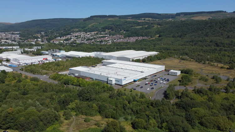
COLEFORD, THE FOREST & THE WYE VALLEY
Aerial photography Gloucestershire
The Forest of Dean gives businesses and property owners a strong mix of town, countryside, historic sites, visitor attractions, industrial locations and dramatic landscapes to work with.
Property and land
Aerial photography is useful for houses, estates, farms, development land and commercial property where conventional ground photographs cannot show the complete setting.
Tourism and hospitality
Hotels, holiday accommodation, attractions and outdoor businesses can use drone photography and video to show their location and surrounding countryside in a way ground-level images cannot.
Construction and business
Coleford, Cinderford, Lydney and the surrounding district include industrial estates, workshops, developments and business premises where aerial coverage can show scale, access and progress clearly.
The Wye Valley and rural locations
Rural sites can produce excellent aerial material. Where dense trees or steep terrain affect the pilot’s visual line of sight to the drone, we simply plan the operating position accordingly.
LYDNEY PROJECT
Camper Pod aerial filming
This project was filmed in Lydney for a camper pod business. The client supplied a specific brief and we followed the requested shots on location, capturing the pod and its setting from the air.
1–2 hours on site
A good example of a compact commercial drone shoot where the requirement is already clear. Rather than producing unnecessary footage, we work through the client’s brief and capture the angles and movements needed for the finished piece.
DRONE COVERAGE ACROSS THE FOREST OF DEAN
Coleford and the wider district
Coverage extends across the Forest towns, woodland settlements, Severn side and Wye Valley.
Coleford, Berry Hill & Broadwell
Coleford, Berry Hill, Broadwell, Mile End, Coalway and surrounding settlements. Property, commercial premises, construction, tourism and inspection work can all be covered subject to the exact site.
Cinderford, Ruspidge & Littledean
Cinderford, Ruspidge, Littledean, Drybrook and Ruardean. A useful area for commercial sites, property, construction, rural business and woodland-edge projects.
Lydney, Aylburton & the Severn side
Lydney, Aylburton, Alvington, Blakeney, Awre and surrounding areas. Property, industry, construction, land and tourism projects can benefit from wider Severn and Forest context.
Newent & the north-east district
Newent, Dymock, Blaisdon and nearby rural areas can be covered for property, agriculture, land, tourism and business projects.
Clearwell, Newland & St Briavels
Historic villages, visitor attractions, accommodation, estates and rural property around Clearwell, Newland and St Briavels are well suited to aerial photography and video.
Symonds Yat, English Bicknor & Lydbrook
Symonds Yat, English Bicknor and Lydbrook offer striking Wye Valley scenery for tourism, property and commercial aerial work. Dense woodland can occasionally limit visual line of sight, which is considered when planning the flight.
Mitcheldean, Longhope & northern Forest
Mitcheldean, Longhope, Huntley and surrounding areas offer a mix of business premises, property, farmland and wooded sites.
Wider Gloucestershire & Ross-on-Wye
For work beyond the district, see our Gloucestershire drone photography and Ross-on-Wye drone photography pages.
HOW A FOREST OF DEAN DRONE SHOOT WORKS
Simple planning before the drone goes up
Send us the location, what you need photographed or filmed and how the material will be used. We can then plan the right aircraft, shots and operating position before attendance.
01
Send the exact location
Include the required stills or video, intended use and any useful access or landowner information.
02
Plan the flight
We check the site, airspace, access, weather and the shots needed before attendance.
03
Capture the required angles
We work through the agreed stills or video shots efficiently, adapting the flight position where the site requires it.
04
Receive organised files
Edited photographs, agreed clips or source footage are supplied digitally for marketing, reporting, property or production use.
DRONE PHOTOGRAPHY COLEFORD & FOREST OF DEAN
Need aerial coverage somewhere in the Forest?
Send the location and tell us what you need. A map pin, brief shot list or example image is useful for planning the shoot.