
DRONE PHOTOGRAPHY & VIDEO IN PEMBROKESHIRE
AERIAL PHOTOGRAPHY & DRONE FILMING PEMBROKESHIRE
Professional drone photography and aerial video across Pembrokeshire for tourism, coastal property, construction, land, inspections, ports, industry, events and commercial projects.
From Tenby and Saundersfoot to St Davids, Fishguard, Haverfordwest, Pembroke and Milford Haven, each flight is planned around the actual location, airspace, access, weather and the views the project needs.

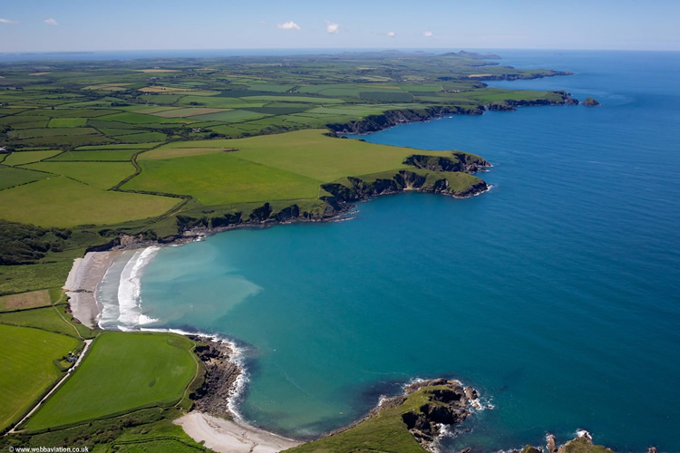
WEST WALES AERIAL COVERAGE
Coast + countryside + industry
GVC + A2 CofC qualified
Commercial drone insurance
High-resolution aerial stills
4K/6K aerial video
Flight planning included
County-wide coverage
| PEMBROKESHIRE FLIGHT PLANNING | COAST • AIRSPACE • WORKING SITES |
Pembrokeshire is not one type of drone location
Coastal work is about more than scenery
For hotels, holiday accommodation, venues and property, the coast can explain location and setting. The aim is to keep the business or property as the subject rather than returning with unrelated landscape footage.
Haverfordwest airspace needs checking
Parts of the county are affected by aviation activity around Haverfordwest. The exact site is checked in advance and any required coordination is dealt with as part of flight planning.
Ports and industrial sites are working environments
Milford Haven, Pembroke Dock and surrounding industrial areas call for a different approach from a quiet rural property. Site rules, vessels, infrastructure, people and operational boundaries all affect the flight plan.
Wind matters on exposed coastlines
Conditions around headlands, cliffs and open beaches can differ sharply from inland forecasts. Where appearance matters, flexibility over the filming window can make a substantial difference.
Sensitive locations need a proportionate plan
Busy beaches, visitor attractions, protected landscapes and sites near wildlife can restrict when and how a flight is practical. The exact location and required shot are assessed before promising a particular viewpoint.
PEMBROKESHIRE DRONE SERVICES
Aerial coverage with a clear job to do
The county of Pembrokeshire in West Wales supports everything from visitor marketing and property to major industrial, construction and infrastructure work.
Tourism & hospitality
Hotels, holiday parks, accommodation, attractions and venues can show their relationship with beaches, towns, harbours and countryside.
Property & land
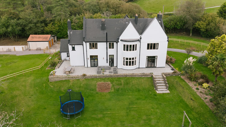
Show homes, estates, farms, development land, grounds and access with views that communicate scale and setting clearly.
Construction & industry
Document progress, external works, yards, plant, access and completed sites for contractors, developers and industrial organisations.
Roof & site inspections
Capture roof areas, elevations, structures and difficult-to-see details with focused imagery that answers the practical question.
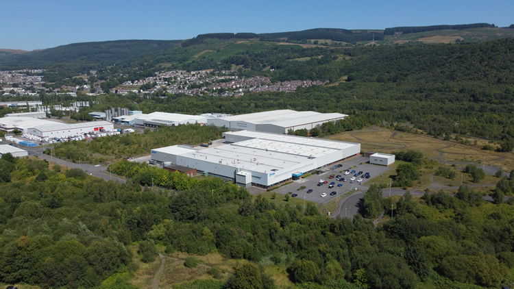
TWO VERY DIFFERENT SIDES OF PEMBROKESHIRE
Coastal destination imagery and serious commercial coverage
Pembrokeshire’s identity is strongly coastal, but aerial work here is not limited to beaches and tourism. The county also contains ports, energy infrastructure, industrial estates, construction sites and working harbours.
Destination context
Tenby, Saundersfoot, St Davids, Newport and the coastal villages benefit from aerial views that explain where accommodation, venues and visitor businesses actually sit.
Ports and infrastructure
Milford Haven, Pembroke Dock, Neyland and Fishguard can require disciplined commercial coverage where the shot list, site contact and operating boundaries matter.
Construction records
Repeatable views can show meaningful change across developments, infrastructure and larger sites without collecting excessive footage.
Land and property
For farms, estates and larger coastal properties, aerial photography can show access, boundaries, outbuildings and surrounding land in a single useful set.
DRONE COVERAGE ACROSS PEMBROKESHIRE
Coast, towns, villages and inland Pembrokeshire
We cover all UK if needed, with reliable network of professional pilots nationwide
Tenby, Penally, Saundersfoot & south-east coast
Tenby, Penally, Saundersfoot, Wiseman’s Bridge, Stepaside, Amroth, Kilgetty, Begelly, St Florence, Lydstep and Manorbier. Strong for accommodation, venues, property, tourism and coastal business imagery.
Pembroke, Pembroke Dock & the south
Pembroke, Pembroke Dock, Lamphey, Freshwater East, Stackpole, Bosherston, Angle, Carew and the Castlemartin peninsula. Suitable for property, construction, tourism, land and commercial projects subject to site and airspace checks.
Milford Haven, Neyland & the Haven
Milford Haven, Neyland, Burton, Llangwm, Hook, Martletwy, Landshipping and Lawrenny. A key area for industrial, port, marine, property, construction and infrastructure work.
Haverfordwest & central Pembrokeshire
Haverfordwest, Treffgarne, Wolfscastle, Llawhaden, Llys y Fran, Maenclochog, Rosebush and Clunderwen. Airspace around Haverfordwest is checked as part of planning.
St Davids & the north-west coast
St Davids, Solva, Newgale, Roch, Nolton, Nolton Haven, Broad Haven, Little Haven, Marloes, Dale, Porthgain, Abereiddy and Trefin. Coastal conditions and visitor activity are important parts of planning here.
Fishguard, Goodwick & north coast
Fishguard, Goodwick, Dinas, Mathry, Strumble Head, Gwaun Valley and Eglwyswrw. Coverage can support marine, tourism, property, rural business and commercial projects.
Newport, Nevern & north-east Pembrokeshire
Newport Pembrokeshire, Nevern, Moylegrove, St Dogmaels, Cilgerran and Cenarth. Rural property, tourism, land and coastal settings are common reasons for aerial coverage.
Narberth, Crymych & inland north-east
Narberth, Crymych, Boncath and surrounding inland communities. Useful for farms, estates, commercial property, visitor businesses, land and construction.
HOW A PEMBROKESHIRE DRONE SHOOT WORKS
Send the exact location before the journey west
A postcode alone may cover a large rural or coastal area. A precise pin or What3Words location helps identify the real operating environment before attendance.
01
Send the site and brief
Provide the exact location, preferred date, required photographs or video movements and intended use.
02
Check airspace and conditions
Airspace, access, coast, terrain, people, neighbouring property and any site-specific operating requirements are assessed.
03
Capture the priority views
The flight works through the agreed stills, inspection areas or planned movements while adapting to weather and activity on site.
04
Receive organised files
Edited photographs, agreed clips or source footage are supplied digitally for marketing, reporting, property or production use.
DRONE PHOTOGRAPHY & VIDEO PEMBROKESHIRE
Need aerial coverage anywhere in Pembrokeshire?
Send the exact location, preferred date and what the photographs or footage need to show.