DRONE PHOTOGRAPHY & VIDEO IN LAMPETER
AERIAL PHOTOGRAPHY & DRONE FILMING LAMPETER
Professional drone photography and aerial video for property, farms, estates, tourism, construction, land, events and commercial productions around Lampeter and the Teifi Valley.
Every flight is planned around the exact site, land access, people, airspace, weather and the material you need to use afterwards.
LAMPETER AERIAL COVERAGE
Photography + drone video
GVC + A2 CofC qualified
Commercial drone insurance
High-resolution aerial stills
4K / 6K aerial video
Lampeter + Teifi Valley coverage
Ground + aerial production available
| LAMPETER FLIGHT PLANNING | TOWN • FARMS • TEIFI VALLEY |
Aerial coverage for property, farmland and rural locations
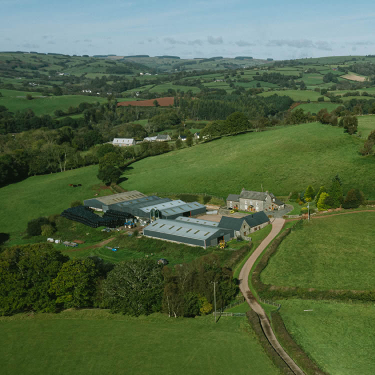
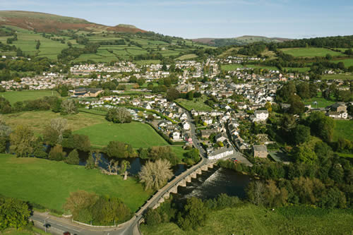
Lampeter is a market and university town in the Teifi Valley, surrounded by farmland, wooded slopes and rural communities. Aerial photography is particularly useful here because it can show the relationship between buildings and land, explain farm or development layouts, document construction progress and give tourism or accommodation films a recognisable sense of place.
There is no single “Lampeter flight”
A town property, university-related location, farm, estate, riverside site or rural business can all require different operating positions and permissions.
Land access and nearby people matter
Roads, public paths, neighbouring homes, land ownership and people around the operating area are checked against the required shot before the flight is confirmed.
Plan around livestock, trees and rural access
Farms and countryside locations can involve livestock, trees, narrow access and several land interests around one view, so the exact operating position matters.
Weather and airspace are part of the shot plan
Current airspace information, temporary restrictions, wind, visibility and the direction of the required view are considered before attendance.
Ground and aerial filming can be combined
Drone South Wales can provide high-resolution aerial photographs and source video, or combine them with professional ground cameras, interviews, sound and editing for a complete promotional or case-study film.
LAMPETER DRONE SERVICES
Choose the type of aerial work
Photography and filming for property, farms, tourism, construction, inspections and commercial projects around Lampeter and the Teifi Valley.
Drone Photography
High-resolution aerial images for Lampeter property, land, farms, tourism and commercial sites.
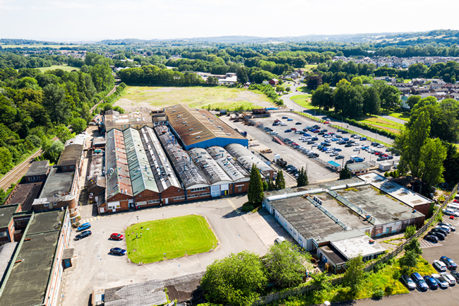
4K / 6K Drone Video
Planned aerial footage for business films, tourism, events, documentary work and online campaigns.
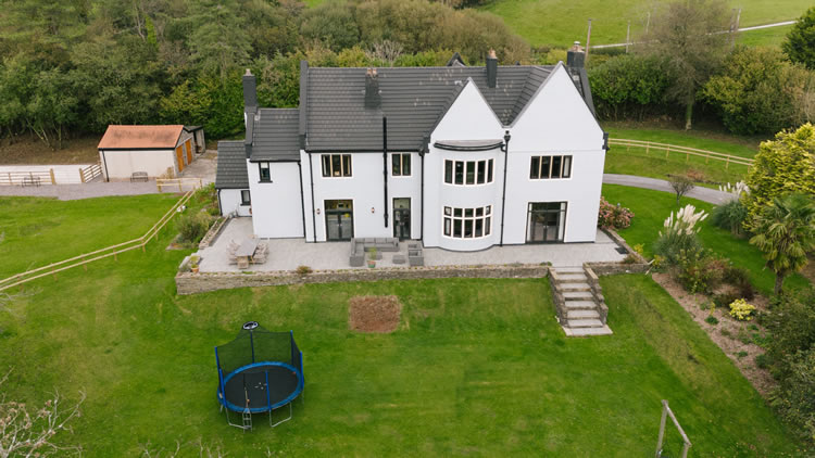
Property & Estates
Aerial photography and video for homes, farms, estates, land, accommodation and property marketing.
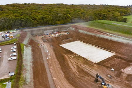
Construction Progress
Repeatable aerial views for building work, development and rural infrastructure projects.
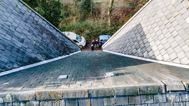
Drone Inspections
High-resolution aerial views of roofs, buildings, farm structures and difficult-to-reach areas.
Tourism & Rural Business
Aerial coverage for accommodation, venues, visitor businesses and promotional work across the Teifi Valley.
LAMPETER AERIAL FILMING SERVICES
Drone photography and video for local projects
The right aerial view depends on whether the client needs to show setting, scale, access, progress, landscape, activity or the relationship between several parts of a site.
Property, estates and land
Show rural homes, estates, development land and commercial property around Lampeter. Aerial stills can explain boundaries, access, outbuildings, fields and surrounding countryside more clearly than ground photography alone.
Tourism, accommodation and outdoor businesses
Give accommodation, venues, activity providers and visitor businesses a genuine sense of location by connecting the site to the Teifi Valley, surrounding hills and rural Ceredigion.
Agriculture and rural enterprises
Capture farms, fields, buildings, machinery, livestock areas and rural businesses with enough context to show how the holding works and how different parts of the site relate to one another.
Construction and development
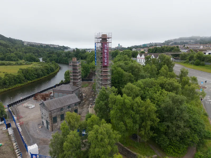
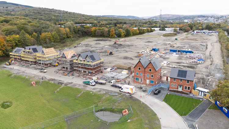
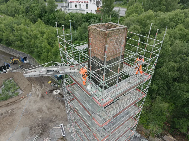
Document building work, site layout, access and completed projects for contractors, clients and marketing. Repeat visits can use recorded viewpoints so later material shows change more consistently.
TV, events and agency production
Provide location openers, reveals, landscape sequences and production-ready aerial footage for documentaries, campaigns, events and wider video productions, with the required shots agreed before the flight.
Ground plus aerial production
Combine drone coverage with interviews, ground-camera sequences, close detail and sound so the finished film explains the business, property or project rather than simply showing it from above.
WHY DRONE SOUTH WALES
Aerial production planned for real Teifi Valley locations
Lampeter projects can involve narrow rural access, livestock, walkers, neighbouring homes, managed land and several land interests around one view. Those details belong in the plan, not as surprises on arrival.
✓
GVC / A2 CofC qualified
Qualified pilot with appropriate insurance and an operating approach matched to the aircraft, location and legal category.
✓
Lampeter and Ceredigion coverage
Regular coverage across west and south Wales makes Lampeter, the Teifi Valley and repeat rural visits practical to schedule.
✓
Aircraft matched to the environment
The aircraft and filters are selected according to available space, people nearby, wind exposure, required image quality and the actual shot list.
✓
Pre-flight checks and RAMS
Airspace, temporary restrictions, weather, land access, people, livestock and safe operating positions are assessed before attendance, with project paperwork supplied where required.
✓
Repeatable project coverage
Construction, estate and land clients can plan return visits around consistent viewpoints and project milestones so change is easier to compare.
✓
Professional ground filming available
Interviews, sound, ground footage and editing can be added when the finished story needs more than aerial imagery alone.
FROM BRIEF TO USEFUL COVERAGE
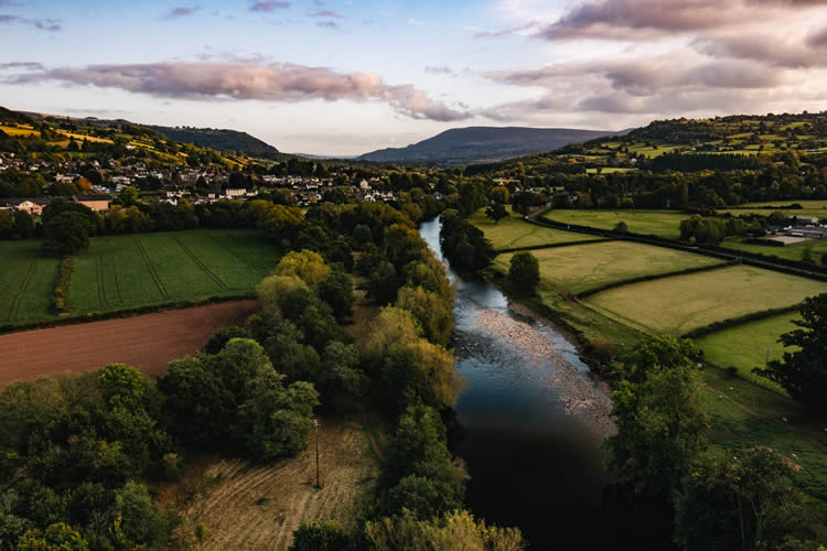
Use the Teifi Valley to explain the location
The existing Drone South Wales example is retained to show the movement and image quality available.
A wider view should tell the audience something
For a Lampeter holiday property or visitor business, the important shot may be the relationship between the building and surrounding Teifi Valley. For a farm, it may be the layout of fields and buildings. For construction, the value is often a repeatable oblique view that makes progress obvious.
Planning that purpose before take-off prevents the flight becoming a collection of attractive but interchangeable landscape clips.
LAMPETER AERIAL PHOTOGRAPHY EXAMPLES
Property, land, construction and rural context
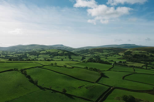
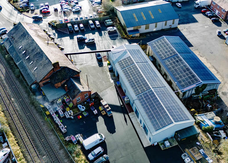
These larger examples leave room for the photographs themselves and show the kind of site context aerial photography can provide.
DRONE COVERAGE AROUND LAMPETER
Lampeter, the Teifi Valley and surrounding rural locations
A market town, river valley, farmland, university locations and rural communities all sit close together around Lampeter. Each needs its own practical flight assessment.
Lampeter town & River Teifi
Property, hospitality and tourism films can use the Teifi Valley and surrounding countryside to establish Lampeter clearly. Roads, pedestrians, riverside land, buildings and private property mean the intended take-off point and camera angle need to be agreed before filming.
University & education locations
Lampeter has a long-established university campus and education buildings within the town. These are managed sites rather than general public operating areas, so any brief involving campus property should include permission from the relevant site manager before filming is arranged.
Llanwnnen, Cellan & Llanybydder
Farms, estates, accommodation and rural businesses around Lampeter can benefit from aerial context. Open countryside still requires a suitable operating position and consideration of livestock, roads, neighbouring homes, public paths and landowner permission.
Ceredigion Council land & public locations
Ceredigion County Council has a formal process for filming on council land. Its published guidance requires an application, risk assessment and public liability insurance, and asks applicants to allow at least three weeks. Council-managed locations should therefore be identified early in the planning process.
GROUND + AIR
Combine Lampeter drone footage with a complete video production
Interviews, sound, ground-camera footage and editing can be added when the finished story needs more than aerial imagery alone.
This is particularly useful for tourism, property, construction and rural businesses where viewers need people, process and detail as well as the wider landscape context.
HOW LAMPETER DRONE FILMING WORKS
From map pin and permissions to delivered footage
Send the exact location early. Around Lampeter, a useful answer depends on the operating position, land access and whether council-managed or other controlled land is involved, not simply the nearest postcode.
01
Send the address, pin and required views
Share the site, preferred date, land or venue contact, intended final use and the photographs or movements you need. Reference images help where a specific direction matters.
02
Check airspace, land access and conditions
We assess current restrictions, weather, people, livestock, roads, trees, property, land management and practical take-off positions before confirming the operating plan.
03
Capture the agreed priorities
The pilot works through the required stills and video while adapting safely to the real weather and site conditions. Ground-camera filming can be included during the same visit.
04
Receive photographs, footage or a finished film
Receive edited aerial photographs, organised source footage, graded clips or a complete film in the formats agreed for your website, property marketing, campaign or production workflow.
LAMPETER DRONE FAQ
Practical questions before booking a flight
Lampeter and the surrounding Teifi Valley contain privately owned farmland, council-managed locations, public paths and other separately controlled sites. Send the exact location for advice based on the land and operating environment.
Can you fly a drone in Lampeter town centre?
Potentially, but the requested shot needs to be assessed first. Roads, pedestrians, buildings, private land, the aircraft, take-off point, nearby people and current airspace information all affect what can be achieved safely and legally.
Can you film farms and land around Lampeter?
Yes. Farms and rural land are well suited to aerial stills and video where the client needs to show boundaries, buildings, access, fields and setting. We plan around workers, livestock, neighbouring property, roads, trees and public paths.
Can you film from Ceredigion County Council land?
Potentially, but Ceredigion County Council has a formal filming process for council land. Its published guidance requires an application, risk assessment and insurance documentation, and asks applicants to allow at least three weeks.
Do you cover Llanybydder, Cellan and the wider Teifi Valley?
Yes. We cover Lampeter and the surrounding Teifi Valley for tourism, property, agriculture, construction, events and production work. Each site is assessed on its own land access, people, livestock, weather and airspace conditions.
Can you film farms, estates and rural property?
Yes. Rural sites are well suited to aerial stills and video where the client needs to show buildings, land, access and setting. We plan around workers, livestock, neighbouring property, roads, trees and the parts of the site that must remain outside the operating area.
Can you make repeat construction progress visits?
Yes. Repeat visits can be planned around project milestones and recorded viewpoints so change is easier to compare. Scaffolding, cranes, vegetation, site activity and weather can still require small adjustments to the exact flight path.
Can you combine drone and ground filming?
Yes. We can add interviews, professional ground-camera footage, close detail and sound during the same production. This is especially useful for tourism, property, construction and rural businesses where viewers need explanation as well as landscape context.
What happens if weather is unsuitable?
Flights only proceed in suitable conditions. Wind, rain, visibility and the required shot direction all matter, particularly on exposed rural sites. Where possible, we agree a practical weather window or alternative date.
DRONE PHOTOGRAPHY & VIDEO LAMPETER
Need aerial photography or drone filming in Lampeter?
Send the Lampeter-area address or map pin, preferred date, required photographs or video shots and the final use. We will check the location, land-access considerations, any council or site-management requirements and the operating environment before responding with a practical approach and quotation.